Lily and I crossed The Continental Divide and arrived on the east side of Glacier National Park on a super windy afternoon. It was so windy that after disconnecting the Airstream we just hunkered down for a day to let the gusts subside before venturing back into the splendor of Glacier.
St. Mary, MT
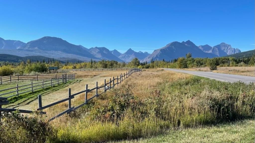
I really liked this side of the park. It felt more remote and isolated and the views made it seem like Glacier was “right there” – especially from the campsite. It was less PNW rainforest and more Swiss Alps, in my opinion.

Once the wind became tolerable, we ventured out to explore the area and check out a few of the popular spots.


Grinnell Glacier
I had been reading about this hike ever since arriving in West Glacier the week before. It seemed a little daunting being 12 miles round trip but I knew I had to do it and see a real live glacier up close. So, on a crystal clear morning I packed some snacks, several bottles of water, bear spray, Advil, and set out on the longest hike of my life so far.
The trail starts at a tiny parking lot near Swiftcurrent Lake just opposite the Many Glacier Hotel. When I arrived at 9:30 am the lot was full so I parked along the road not too far from the trailhead. I felt lucky to find parking anywhere since this is one of the most popular hikes in the park.


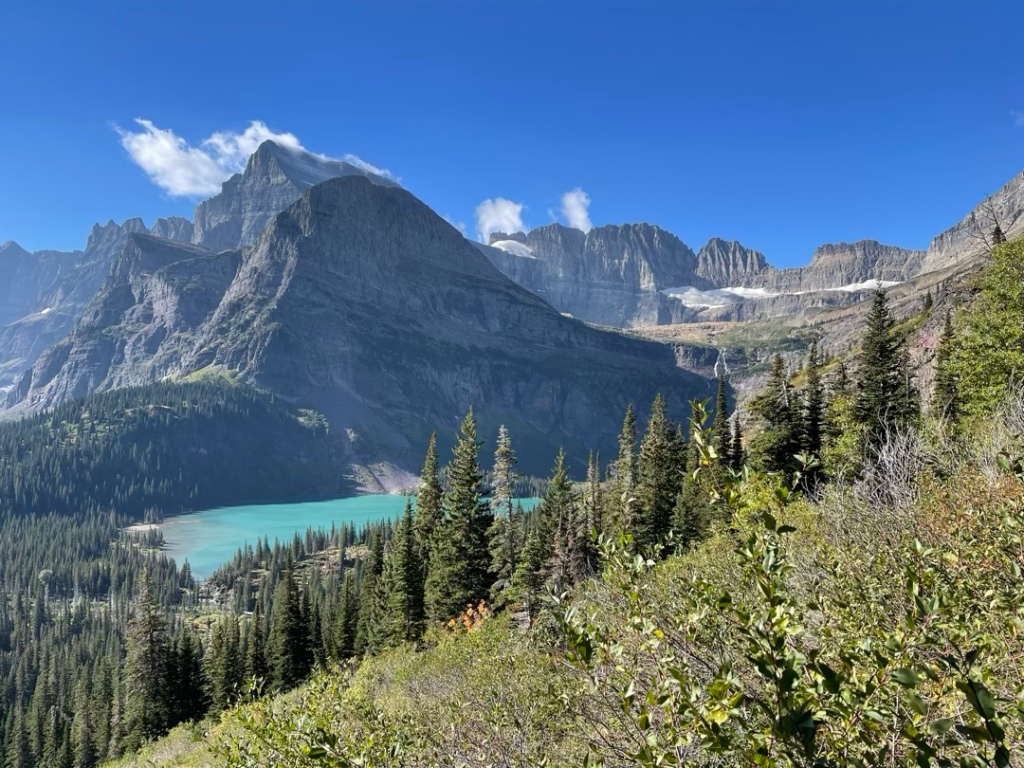
After 2 miles you begin the climb and really start to feel the gain in elevation. Eventually, Grinnell Lake came into view with its stunning turquoise glow. About a mile later the trail became a stone path carved into the side of the canyon.


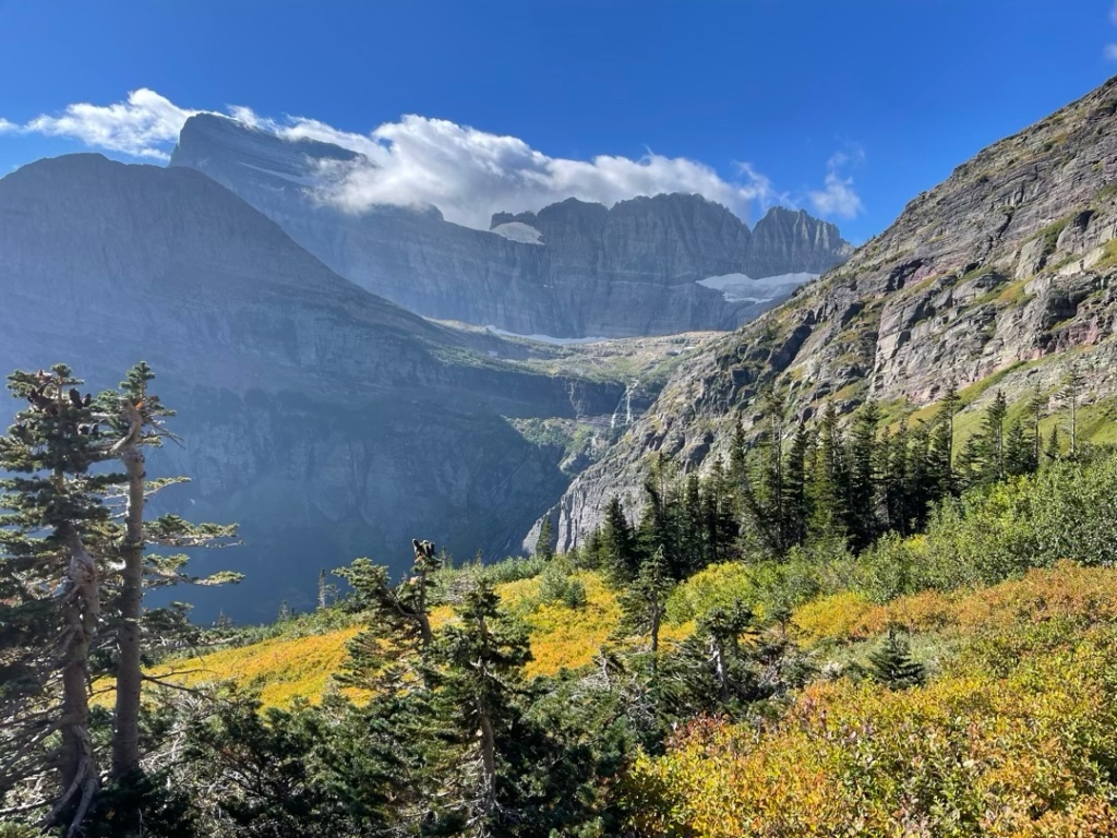
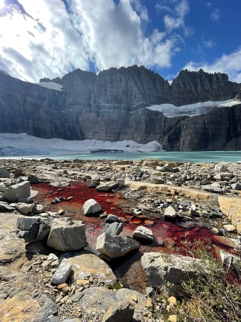
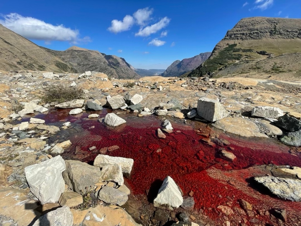
At the 4 mile mark I finally got a glimpse of the top of the glacier and the waterfall that feeds Grinnell Lake from the glacial melt off. The trail through the valley gave way to a narrow cut in the cliff that takes you to the switchbacks where most of the traffic congests as hikers stop to catch their breath on the way to the finish line.
I didn’t get any pics of the switchbacks because they were too steep and it was jammed with other hikers gasping for air while slowly traversing up. Then, finally, at the top and completely out of breath, I arrived at Grinnell Glacier and Little Grinnell Lake. It was really awesome.
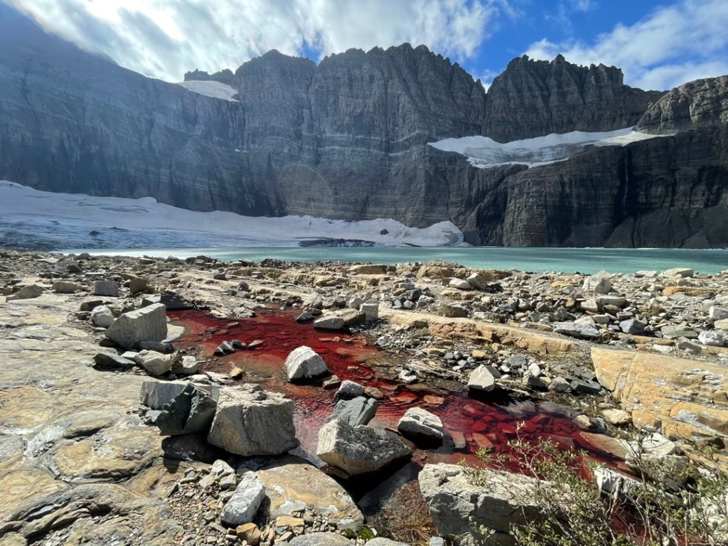
Sadly, the glaciers are rapidly melting and Grinnell Glacier has been retreating dramatically since about 1950. In 2003, a study concluded that nearly two-thirds of the 150 glaciers that existed in Glacier NP had completely melted by 1980. So, I’m greatful I had the opportunity to see this before it’s completely gone.
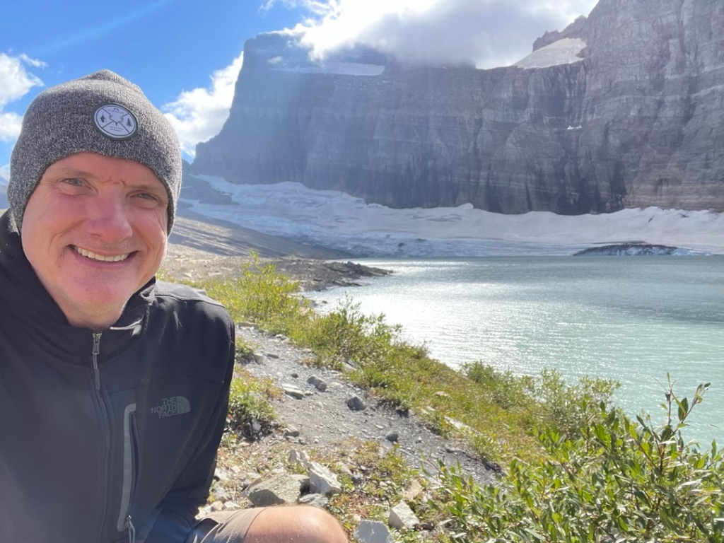
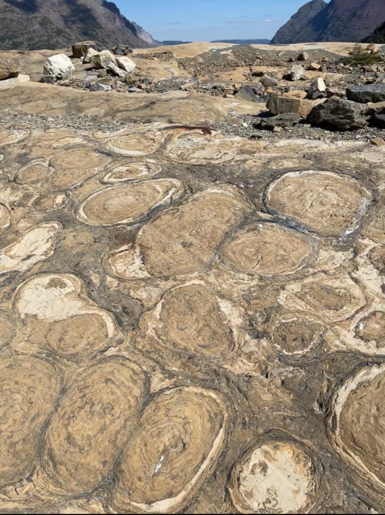


I spent about 45 mins hiking around, taking pics, and observing the interesting rocks all around. There were quite a few other hikers there but when they started packing up and leaving the place felt a little spooky. So, I too packed up and hit the trail for the 6 mile hike back down.
Back home at the Airstream, I felt pretty accomplished and happy. It was such a great day and an amazing experience. And just like that, our time in Glacier came to an end. We spent 9 days inside this Crown of the Continent and it was the perfect way to kick off our second Airstream Adventure.
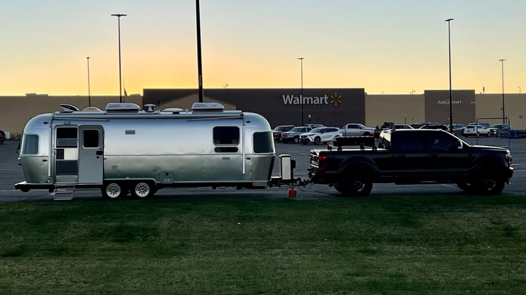
Next up, we continue east along the Lewis & Clark route of northern Montana until reaching North Dakota and dipping down into Theodore Roosevelt National Park and then crossing into Northern Minnesota. Along the way we stopped overnight at Walmart to stock up on supplies and relax.
See you soon for the next adventure update. Until then, check out @paulandlilygoplaces on IG for more pics and videos. Stay safe and happy travels.

Love traveling along with you and Lily❣️ Keep posts coming
LikeLike
Thanks for sharing Paul!!! Love the pics😍
LikeLike
The “Swiss Alps” looks stunning!
LikeLike
Paul nice meeting another Washingtonian. Great blog and happy travels. Greg and Kathy
LikeLike